Road-Trip Through Montana’s Bitterroot Valley
In-the-know locals treasure the valley as a place to relax, explore, and refresh any season of the year.


The word is out on Montana—people come here from all over the map for a Big Sky Country experience—but some spectacular places have largely avoided the fanfare. Consider the Bitterroot Valley, a history-rich stretch of small towns, large ranches, high-payoff trails, and big Montana views along the untamed Bitterroot River, all within an easy drive of Missoula. As snow piles up on the Bitterroot Mountains to the southwest and the Sapphire Mountains to the north, the valley shifts into winter mode, a time for snow-gazing, shopping, and soaking.
Missoula to Lolo
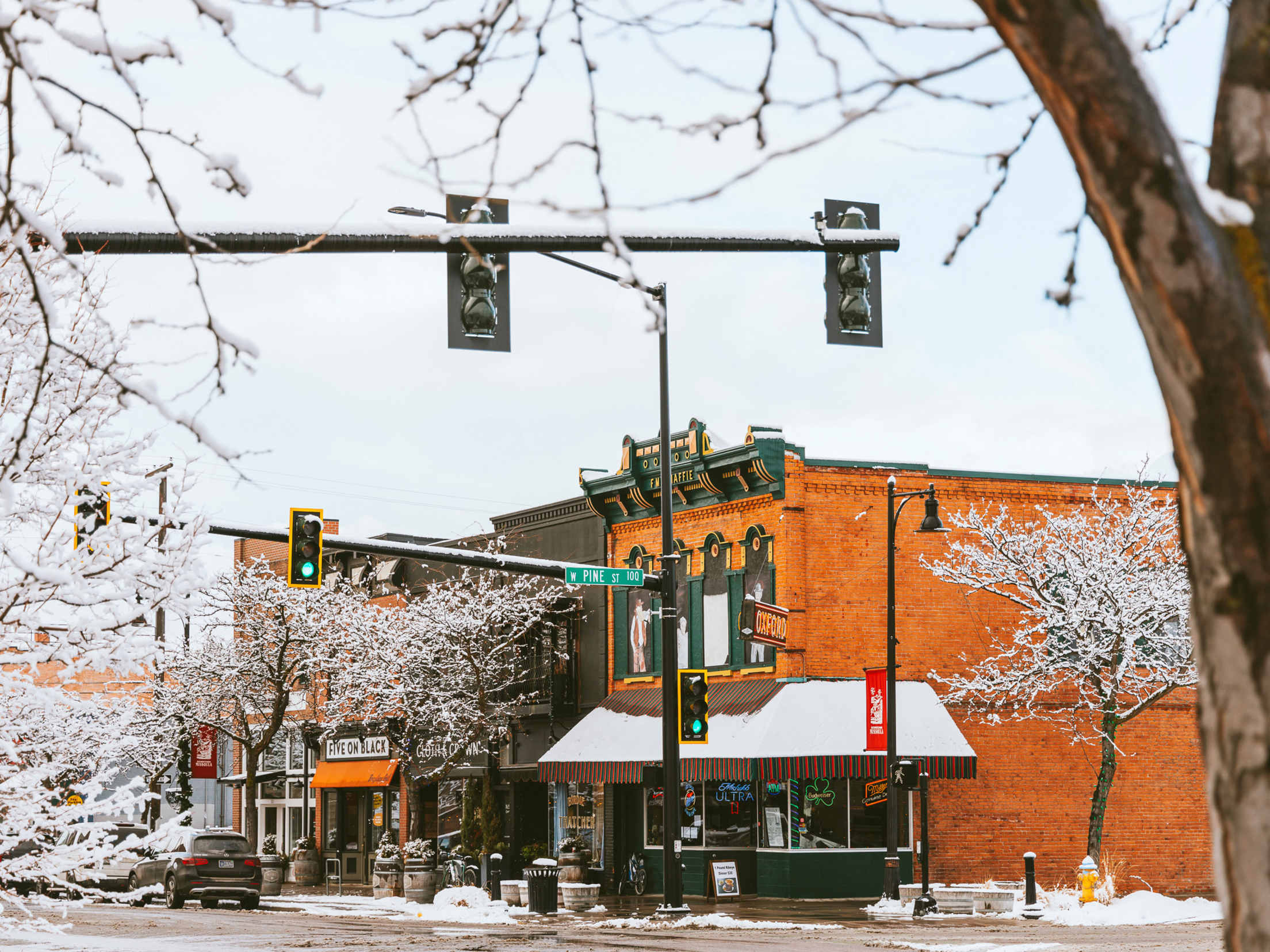
A university town and the unofficial capital of Western Montana, Missoula (population 73,000) is the obvious jumping-off point for a Bitterroot journey. Stop by Bernice’s Bakery for freshly made huckleberry Danishes or a bag of sugar cookies for the road. If you have time to linger over a big plate, try the biscuits and gravy or steak and eggs at the always-open Oxford Cafe.
From Missoula, it’s a quick 10-mile drive to Lolo (pop. 4,400), a mountain town with a long history of visitors. The Lewis and Clark Corps of Discovery paused at what is now Travelers’ Rest State Park on their way to and from the West Coast. On Saturdays in January through early March, speakers carry on the winter storytelling traditions of the Salish tribe with talks at the park. Modern explorers will be tempted to plunge into the indoor and outdoor pools at Lolo Hot Springs. Water with a natural temperature of 102 to 106 degrees—perhaps combined with a tiramisu hot chocolate from the bar—will melt away any winter chills.
Lolo to Stevensville
Less than 10 miles from Lolo, Highway 93 drops into the northern edge of the Bitterroot Valley and the riverside towns of Florence (pop. 1,000) and Stevensville (pop. 2,100), a popular stop for treasure hunting at the Creamery Antique Mall and other Main Street shops.
The Mission Bistro in Stevensville is a reservation-recommended destination dining spot serving locally sourced racks of lamb, bison burgers, and huckleberry cheesecake.
To help make room for dessert, you can take a peaceful winter walk at the nearby Lee Metcalf National Wildlife Refuge, where deer tracks crisscross the snow along the riverbank and northern pintails and green-winged teals jostle for space on open patches of water.
Stevensville to Hamilton
The views of the Bitterroot and Sapphire Mountains continue to inspire along the 20 miles or so from Stevensville to Hamilton, with the small towns of Victor and Corvallis along the way. The pines and snow-covered peaks don’t exactly evoke wine country, but the Hidden Legend Winery in Victor sells bottles of sweet and punchy meads made with local fruits and honey. In winter, the Teller Wildlife Refuge just outside of Corvallis teems with ducks, coots, and even tundra swans making the most of the free-flowing Bitterroot River.
Hamilton (pop. nearly 5,000), has restaurants, shopping, and activities befitting the “big town” of the valley. If you’ve somehow made it this far without getting full, consider a classic Montana meat pie at the MineShaft Pasty Company. The Ravalli County Museum houses a collection of pioneer-era farm tools, clothes, and artwork as well as artifacts from Salish, Nez Perce, and Kootenai tribes.
If you have the urge to get closer to the mountains, the Blodgett Canyon Trail outside of town will take you past a tumbling, icy creek and sheer granite rock faces with only minimal elevation gain. On most winter days, you can walk miles on the packed trail without snowshoes. Lake Como, a beautiful mountain lake south of town that hums with activity in warm months, becomes a quiet spot that cross-country skiers pass in winter.
Hamilton to Sula
The final stretch of the Bitterroot Valley goes through Darby (pop. 800), the timber town that’s home to the Ranger Station Museum—a good spot to learn about forest service history while getting local tips for exploring the valley—as well as the fun and fudgey Old West Antiques & Candy Store. Fans of the TV show Yellowstone will recognize the “Dutton Ranch” located just down the road. The highway continues to Sula (population less than 100), the southernmost town in the valley, where winter-weary travelers stop at Lost Trail Hot Springs, another hot spot for visitors to stay and soak.
Highway 93 proceeds south into Idaho, but if you turn around and head back to Missoula, you’re bound to see sides of the Bitterroot that you missed the first time. It’s a valley of many parts, and it’s all Montana.