Road-Trip Through Nevada’s Moapa Valley
Eye-catching rock formations, desert wildlife, and mementos of history make this day trip from Las Vegas a win.

The Moapa (pronounced mo-AH-puh) Valley is only about an hour’s drive northeast of Las Vegas along I-15, but it couldn’t be more different from the Entertainment Capital of the World. Instead of towering resorts, clanking slot machines, and spheres covered in digital signage, you’ll find spires of sandstone, bleating bighorn sheep, and petroglyphs that date back 4,000 years. The juxtaposition is as refreshing as it is stark, making the region a perfect destination for a daylong road trip from the Las Vegas Strip.
Valley of Fire State Park
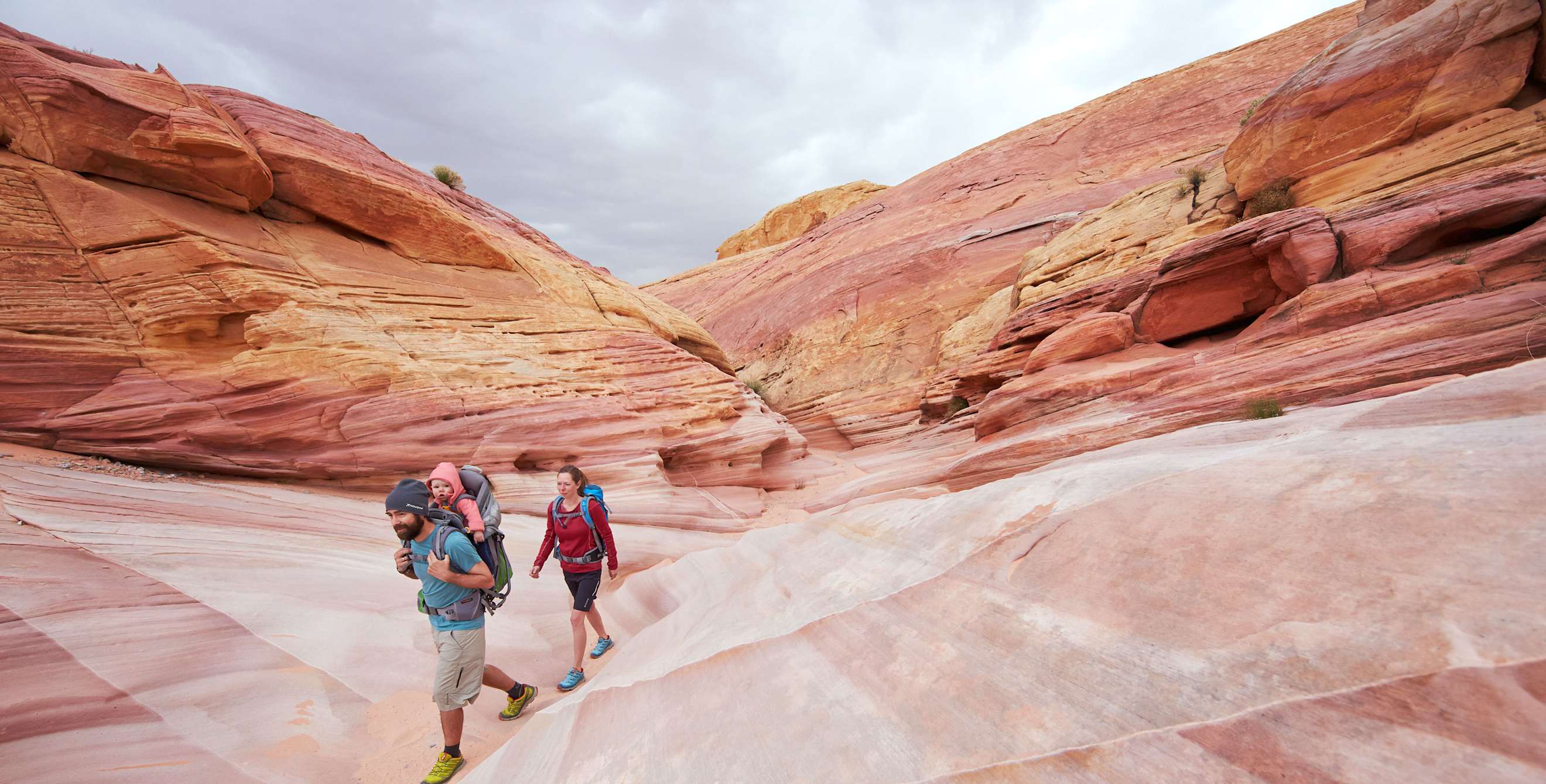
One of the main attractions in this part of Nevada is Valley of Fire State Park. At nearly 46,000 acres, the park is Nevada’s largest. Officially designated by the Nevada State Legislature in 1935, it also holds the distinction of being Nevada’s first state park. It derives its name from the way its red sandstone formations—which were sand dunes during the time of dinosaurs 150 million years ago—seem to glow as if they are on fire just before sunset. Water and wind erosion have shaped the landscape for centuries, creating almost otherworldly shapes and designs out of rock. The park also is notable for its evidence of Native American occupation; petroglyphs (carvings) on certain rocks throughout the park are thought to be more than 2,000 years old.

The best ways to explore Valley of Fire are by car and on foot. Most trails are sandy and stretch no more than a mile, offering visitors the opportunity to drive around and explore several different areas in a day. Mouse’s Tank, for instance, is about three-quarters of a mile out-and-back, and features petroglyphs as well as a natural pool at the end. Rainbow Vista is about a mile out-and-back; the turnaround point looks out on a canyon with alien-like sandstone formations. Balancing Rock, which leads to a boulder that appears to be balancing on another, is a quarter-mile hike from the visitor center. The longest trail in the park, Fire Wave, is a 1.8-mile loop with slot canyons and multicolored formations that look like rock rainbows.
Because Valley of Fire is in the middle of the Mojave Desert, bringing water is essential year-round. It’s also a good idea to have a camera easily accessible; bighorn sheep, Gila monsters, and rattlesnakes roam freely in the park, and you’re practically guaranteed to see some bighorn sheep (or prints in the sand) at least once.
St. Thomas
Let’s be clear: St. Thomas isn’t a modern-day municipality; it’s a ghost town inside the boundaries of Lake Mead National Recreation Area. Like many Mormon settlements in the Moapa Valley, this was once a thriving metropolis between Los Angeles and Salt Lake City. When the Hoover Damn was in the 1930s, the town was flooded. Over time, as water levels in the Overton Arm of Lake Mead have dropped, remnants of St. Thomas have re-emerged. Today, on the two-and-a-half-mile-long Trail to St. Thomas, you’ll find portions of several buildings, including an old ice cream parlor and a school. The National Park Service has added signage and historic images to help visitors imagine what the town once was.

Overton
Moapa Valley Boulevard—aka State Route 169—heads north from Lake Mead National Recreation Area to the heart of the Moapa Valley and the region’s largest population center, Overton. In the 1880s, this was home to the lower valley’s only store. Today, several attractions make it a popular stop.
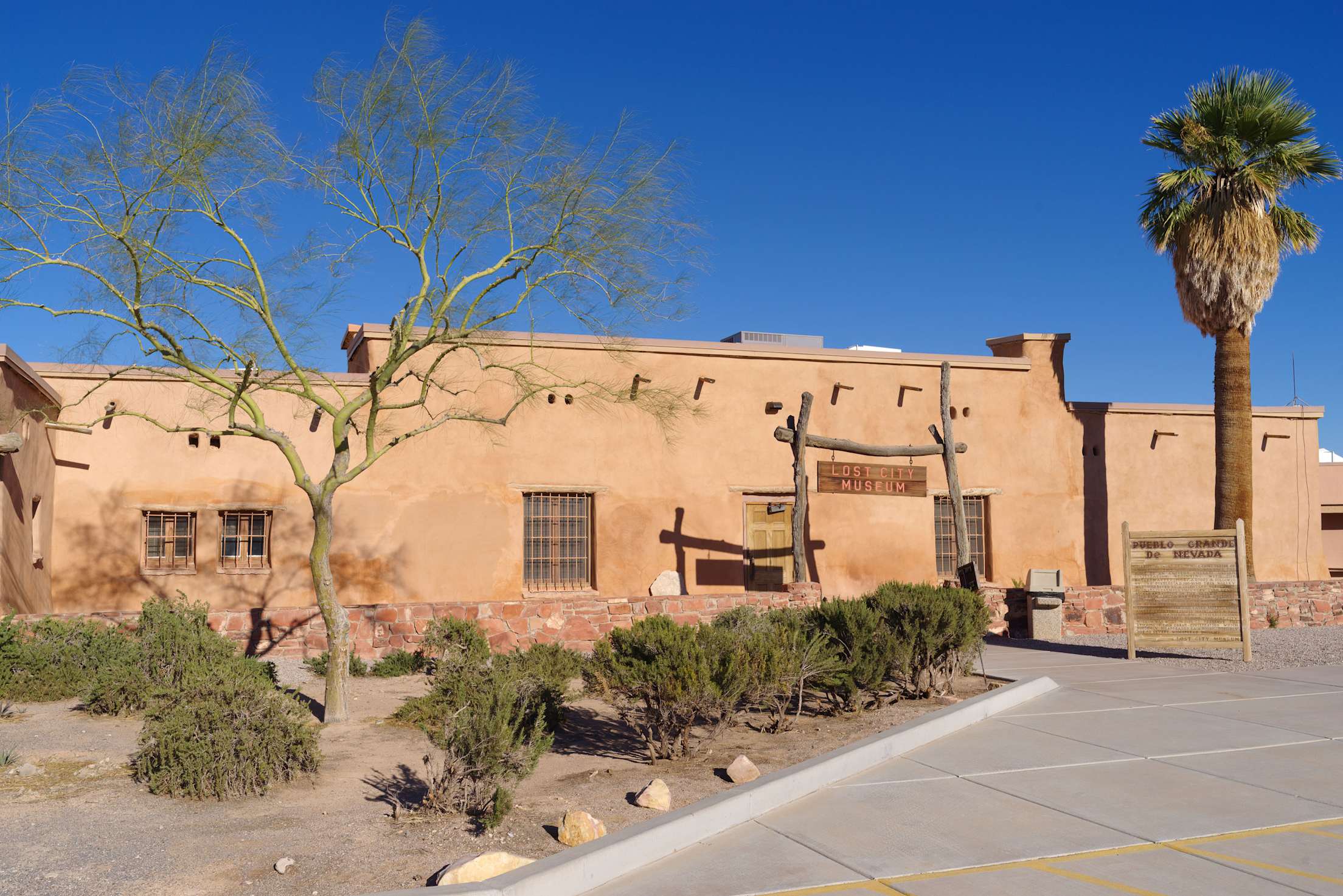
Number one on that list is the Lost City Museum, a state-run facility that sits on a ridge overlooking the valley below. The National Park Service created the museum in 1935 to exhibit artifacts recovered from prehistoric archaeological sites excavated before the creation of Lake Mead. The resulting collection of baskets, pottery, arrowheads, and more is extensive, providing a fascinating narrative of the region’s history. Outdoor exhibits include a Native American pit house and reconstructed pueblos, which kids (and very slender grown-ups) can enter and explore.
Also worth exploring: Criss Angel’s Breakfast, Lunch & Pizza, or CABLP. As the name suggests, this restaurant is owned by Criss Angel, a magician who has performed at various hotels in Las Vegas for the better part of the last two decades. Angel opened the eatery in late 2021 as part of an effort to build an adventure camp in the upper valley for children with medical challenges. Be sure to try the New York–style pizza and the Italian ices, also made in the style Angel enjoyed as a kid growing up in suburban New York.
Logandale
There isn’t much in Logandale itself, but this region is known nationally for a system of mountain-biking and dirt-biking trails. One of the most famous of these trails is the roughly four-mile Jackrabbit Loop, with small jumps and moderate climbs and drops. For visitors who don’t have their own bikes, rentals are available at Bike Access, a company that will deliver bikes to you directly, even at the trailhead.