Complete Guide to Pinnacles National Park
In California’s Central Valley, caves and spires are the backdrop of this biodiverse destination.


About 75 miles south of the San Francisco Bay Area and 40 miles inland, eroded leftovers of an extinct volcano form Pinnacles National Park. Upgraded from a national monument in 2013, California’s youngest national park is just as well known for its heights as its depths. The east and west sides are connected only by foot trails through the dramatic peaks and mysterious talus caves, formed when the Pacific Plate and North American Plate shifted along the San Andreas Fault, splitting the Pinnacles-Neenach Volcanic Field around 23 million years ago.
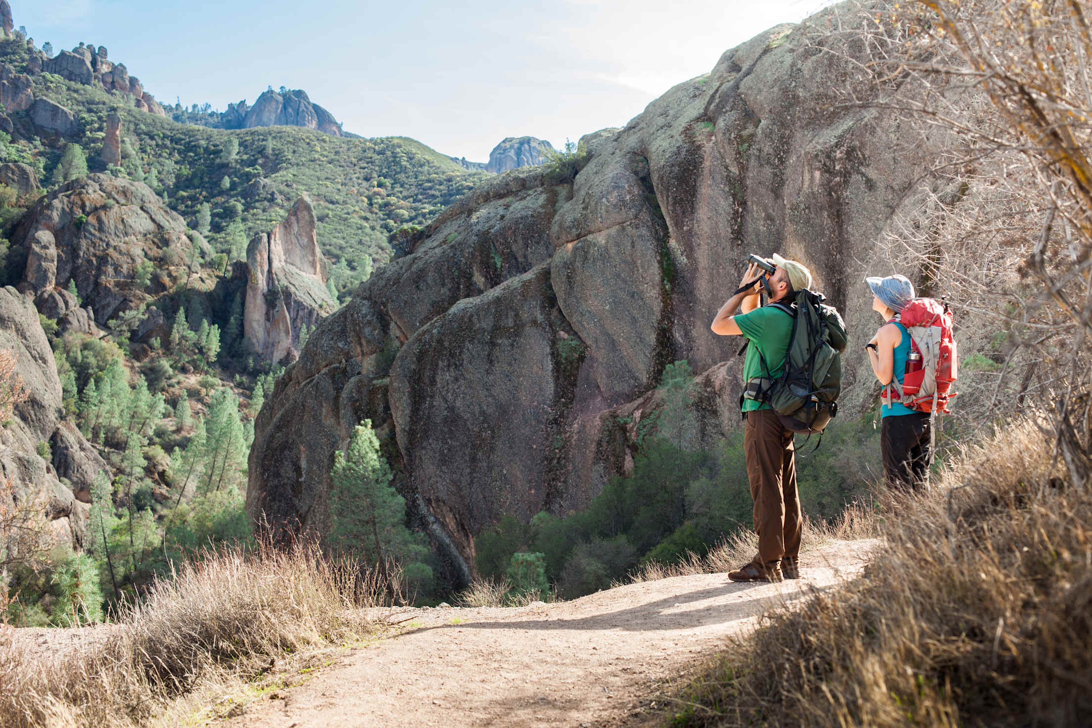
From the pointed spires and canyon cliffs, North America’s largest wild bird, the California condor, soars overhead among other raptors. The park also protects other sensitive species like the endangered Townsend’s big-eared bats, Gabilan slender salamander, and Pinnacles shield-back katydid, even as park boundaries abut human development.
Over the years, intrigue in the park has increased, with visitation nearly doubling from 177,000 tourists in 2019 to 349,000 in 2021. Whether it’s scrambling through a cave or catching sight of a condor that piques your interest, there are numerous reasons to visit this biodiverse haven.
Top Attractions in Pinnacles National Park
This 26,000-acre park has an entrance on the east side where there’s more shade and water, and another on the west side, which features high rock walls. No roads cross the park, only hiking trails, and it’s at least an hour drive between the two entrances. To make the most of your visit, map out your stops based on which side they’re located within the park.
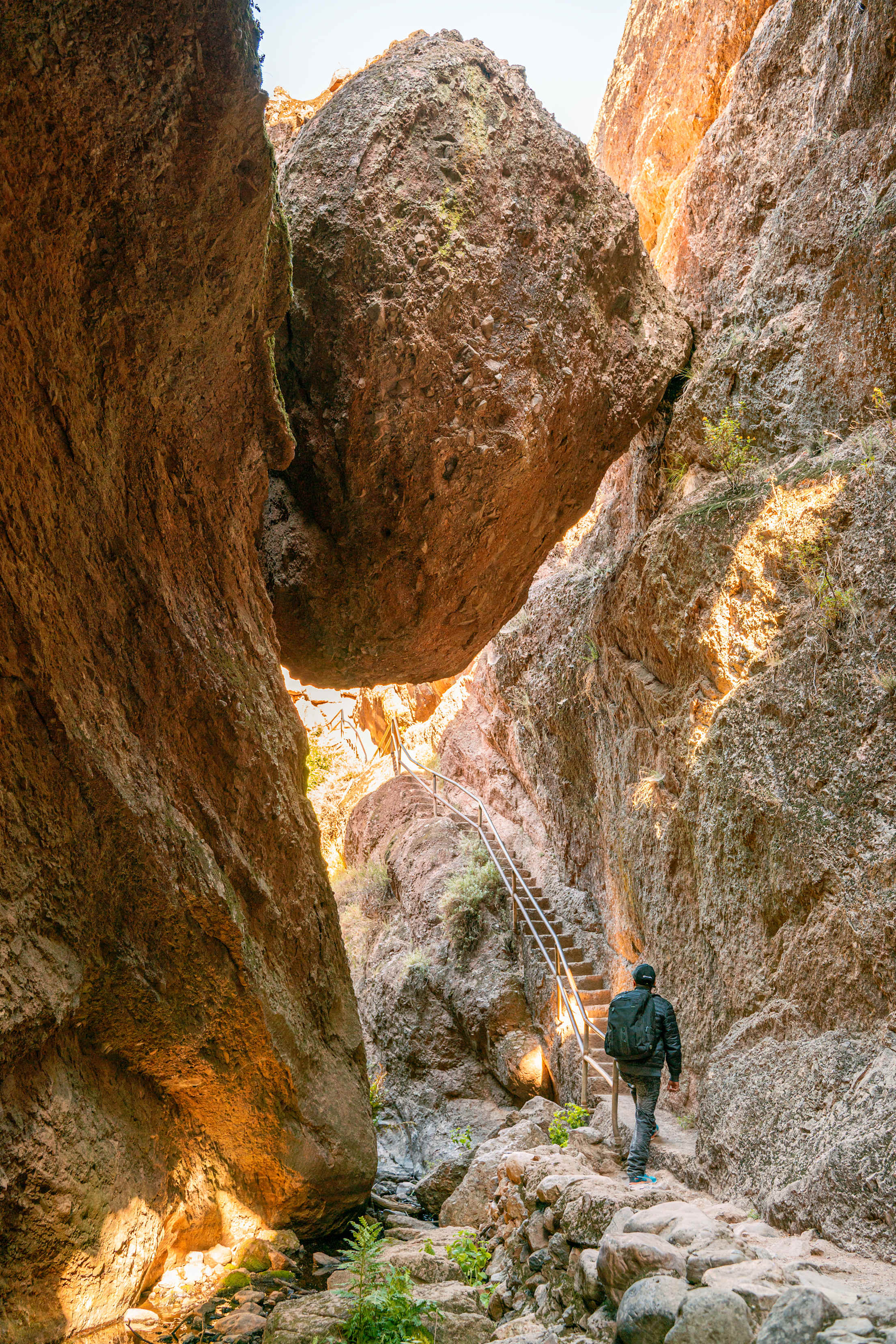
On the east side, the iconic Bear Gulch Reservoir is surrounded by towering rock formations and home to the threatened red legged frog. To get there, park at the Moses Spring Parking Area or Bear Gulch Day Parking Area. The trail leads through Lower Bear Gulch Cave, another top attraction, on a concrete path and stone steps to darkness.
Upper Bear Gulch Cave is only open for a few weeks each year to protect the endangered bats living there. For a peek into the caves without the scrambling, head to the Bear Gulch Nature Center to chat with a ranger and watch the park’s feature film.
On the west side, Balconies Cave is less visited and developed. From the Chapparal Parking Area, you can head out for 2.4 miles round trip through talus passages—or you can turn around early. Several other trails intersect with this route, such as the 9.3-mile round trip North Wilderness Trail Loop.
Where to Go and What to Do
Cave exploring
The park’s unusual talus caves were created when gigantic boulders toppled from cliff edges into the canyons that were formed by fractures and faults in the volcanic rock. Trails through the Bear Gulch and Balconies caves feature stairs, bridges, tight corridors, and slick and uneven terrain, so be sure to wear sturdy walking shoes or hiking boots. Rangers require flashlights in the caves, and a walking stick or trekking poles could also come in handy. Unfortunately, the caves aren’t accessible to wheels because of the terrain.
Take note that parts of the cave close every year to protect a colony of endangered Townsend big-eared bats while they breed and raise their young. Check the schedule here.
Hiking
Leave your car and get to know the park better on more than 30 miles of trails through flat stretches of grasslands, through the caves, and up steep climbs to the rocky spires. Many trails lead to and through the caves, but not all.
Out of the park service’s recommendations, the 2.2-mile round trip Moses Spring to Rim Trail Loop is one of the easier hikes. Or head up the 1.7-mile one-way Condor Gulch Trail for a view of the high peaks and, hopefully, flying raptors. For a longer day, the 4.3-mile round-trip Juniper Canyon Loop climbs switchbacks and circles the rock formations. Or the 8.4-mile roundtrip High Peaks to Balconies Cave Loop extends talus exploration into a mix of climbing and flats.
A section of the Bench Trail between Peaks View and South Wilderness Trail, where you can catch vistas of the High Peaks formation, was recently hardened and graded for wheel access.
Bird Watching
Whether you’re hiking or picnicking, bring your binoculars and bird field guides. Pinnacles has one of the highest densities of prairie falcons in North America, and is also home to a smaller community of peregrine falcons. If that’s not enough to look at, the park has been a release site for California condors since 2003 and manages a population of 25 free-flying condors. Bonus sightings include the oak titmouse, golden eagle, yellow-billed magpie, and more than 180 other species documented in the park. Here are a few spots to look for them.
When to Go
Rising between Pinnacles and the Pacific Ocean, the Santa Lucia Mountains block the cooling influence of the sea, allowing park temperatures to frequently reach the 100s in the summer. Fall and spring are much more temperate though busier, and you can catch the wildflowers blooming in March and April except during years of extreme drought. Winter is also a beautiful time to visit with snow dusting higher elevations between December and January.
Where to Camp and Stay
Off Pinnacles Parkway on the east side, the Pinnacles Campground has 134 campsites spread out across five different loops for tent, tent cabin, and RV camping, which you can reserve up to six months in advance at recreation.gov. For group sites accommodating up to 20 people, reservations open 12 months in advance.
Most RV sites have electrical hookups, and there’s an on-site dump station. Drinking water is available throughout the campground, and bathrooms have coin-operated showers. From the middle of April through the end of September, the unheated swimming pool is typically open.
Outside the park, you can find hotels up and down Highway 101, with Salinas and Hollister to the northeast offering the most options.
Remember, Tread Lightly
Every year, the caves close for flooding, rockfalls, and bats, as well as vandalism. Keep these spaces open to more visitors by respecting the environment. Take note that pets aren’t allowed in most places in the parks, except picnic areas, parking lots, paved roads, and campgrounds.
To protect this haven for years to come, practice these Leave No Trace principles: plan ahead and prepare, travel and camp on durable surfaces, pack out what you pack in, dispose of waste properly, leave what you find, don’t feed wildlife, and be considerate of others.