Best Scenic Hikes in the East Bay
A small effort leads to big scenic payoffs in three East Bay regional parks.


Though the East Bay, which includes parts of Alameda and Contra Costa counties, is densely populated, the region is also home to over 119,000 acres of open space maintained by the regional park district. On 65 different preserves, 1,200 miles of trails pass through sheltered forests and breezy hills with endless views. Here are three of our favorite walks in the area.
Coyote Hills Regional Park
Perched on the water's edge in Fremont, this park boasts bird-filled marshes and hilltop vistas of the Bay, both of which are easy to reach. Take the Chochenyo Trail through wetlands full of ducks, white pelicans, big-footed American coots, and other birds. Then head north and take the Red Hill Trail up two low peaks that offer stunning views of multicolored salt evaporation ponds, San Francisco, and planes landing at SFO. Multiple trails lead back to the parking area, so you can make the walk as short as 3.5 miles or stretch it out for as long as you'd like to enjoy this enchanting bit of shoreline.
Redwood Regional Park
On the quiet side of a valley high in the Oakland Hills stretches a five-mile swath that may be the state's oldest second-growth redwood grove. "When you're in the middle [of the park], surrounded by lush forest and greenery, it's like you're deep in the forest," says Michael Charnofsky, a naturalist for the parks. "Many people feel it's the jewel of the park system."
A great place to start is the redwood-shaded Stream Trail from Canyon Meadow Staging Area. At 1.5 miles in, the Prince Trail branches off, heading up through chaparral and mixed woodland to the East Ridge Trail, a 2-1/4-mile route back to your starting point, full of big views of the surrounding hills. Before turning off on Prince, though, look for clumps of thousands of ladybugs. They arrive in November to hibernate, then wake to mate in February (weather depending) before heading elsewhere for the warm season.
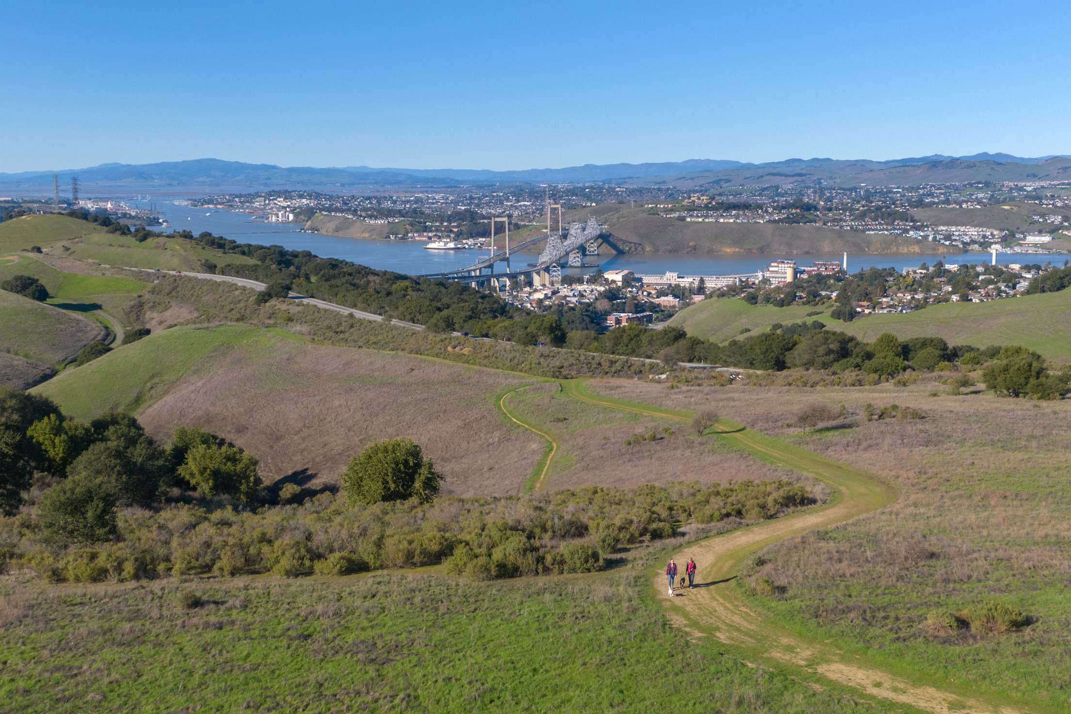
Crockett Hills Regional Park
Industry and nature have both shaped the bay's shoreline, and Crockett Hills Regional Park facing the Carquinez Bridge weaves them together. From the Crockett Ranch Staging Area, a 1.5-mile walk up the Edwards Loop Trail snakes through oaks and bays to a tunnel under Cummings Skyway. Here, hikers get one of naturalist Anthony Fisher's favorite views, a tree-filled valley framing the bridge and the C&H Sugar plant, which still receives shipments of Hawaiian cane by boat.
On the tunnel's other side, the Soaring Eagle Trail leads into rolling ranchland and brings hikers to a high point: the short loop made by the Big Valley and Sugar City Trails, with views overlooking the Carquinez Strait. "You're on top of the whole world here," says Fisher. In winter and spring, look for golden eagles, red-tailed hawks, and other raptors over the park's southern end.