Complete Guide to Mt. Rainier National Park
Explore waterfalls, alpine wildflowers, and more.


If you’ve been to Seattle on a clear day, you’ve likely seen majestic Mt. Rainier—with its peak at 14,410 feet—rising high above the skyline. One of the tallest mountains in the United States, it watches over west-central Washington like a silent protector.
With over 236,000 acres of glaciated peaks and craggy ranges, old-growth forest and flowing rivers, Mt. Rainier National Park is full of stunning scenery. Established in 1899, it was the fifth national park in the U.S. and the first created from a national forest. Visitors can hike, camp and enjoy a leisurely drive around the massive mountain, which forms a third of the park’s acreage. Here’s how to take advantage of the park’s many wonders.
Top Attractions
Most visitors from Portland and Seattle enter the park at the southwest Nisqually entrance, which is open year-round. It is marked by a historic arch about 6 miles east of Ashford, Washington. Be patient at this popular entrance, as there are often long lines in summer, though this will likely be changing this year with a new timed entry system.
About 6.5 miles in, you’ll reach Longmire, a National Historic Landmark District and the first area established in the park. Stop here for information and exhibits, as well as dining and lodging.
In the south-central portion of the park Paradise has a popular visitor center that overlooks the south side of Mt. Rainier and the park’s largest historic lodge with its stunning lobby. Take in an exhibit or film, or chat with a ranger here before your hike at the Henry M. Jackson Visitor Center in Paradise.
If you’re coming from the northeast, plan to start at the Sunrise Visitor Center. This area boasts the highest elevation accessible by a car at 6,400 feet. It’s closed in winter, but features a picnic area and rest stop for quick eats in summer. You’ll find glorious views of the eastern side of Mt. Rainier, Emmons glacier, and more at Sunrise Point.
The Ohanapecosh area, including a well-appointed visitor center and campground, is just a few miles from the Stephens Canyon entrance in the southeast part of the park. Here, you’ll find lower elevations and thus more diversity in plant life.
Just looking for some peace and quiet? Head to the northwestern Carbon River entrance, with excellent backcountry hiking along Carbon River and around Mowich Lake, which opens in July. This area has few amenities, just thousands of acres of temperate rainforest and glacier-fed waterways.
Planning Your Trip
The park’s accessibility varies according to weather conditions, so be sure to check the national park website for updated information before you go. From November to May 1, you are required to bring tire chains for motorized vehicles. Many of the roads and campgrounds are closed from November 1 until late May—or later. Higher-elevation trails may still be covered in snow until June or July.
Summer brings wildflowers, lovely weather, and crowds. Parking is often difficult in popular areas. You’ll want to visit on weekdays and arrive as early as possible. A new timed entry permit program should help with overcrowding in 2024. From 7 a.m. to 3 p.m, permits will be required for daytrippers in the high season for the two major thoroughfares in the Paradise corridor (May 24 to September 2, 2024) and the Sunrise corridor (July 4 to September 2, 2024).
Smart Tip: Before you leave, download the National Park Service app, which provides interactive maps, park amenities, accessibility options. Most of the park lacks cellular service.
Note that dogs are only allowed at campgrounds, in parking lots, and on roads. They must be leashed and stay with you at all times.
Where to Hike
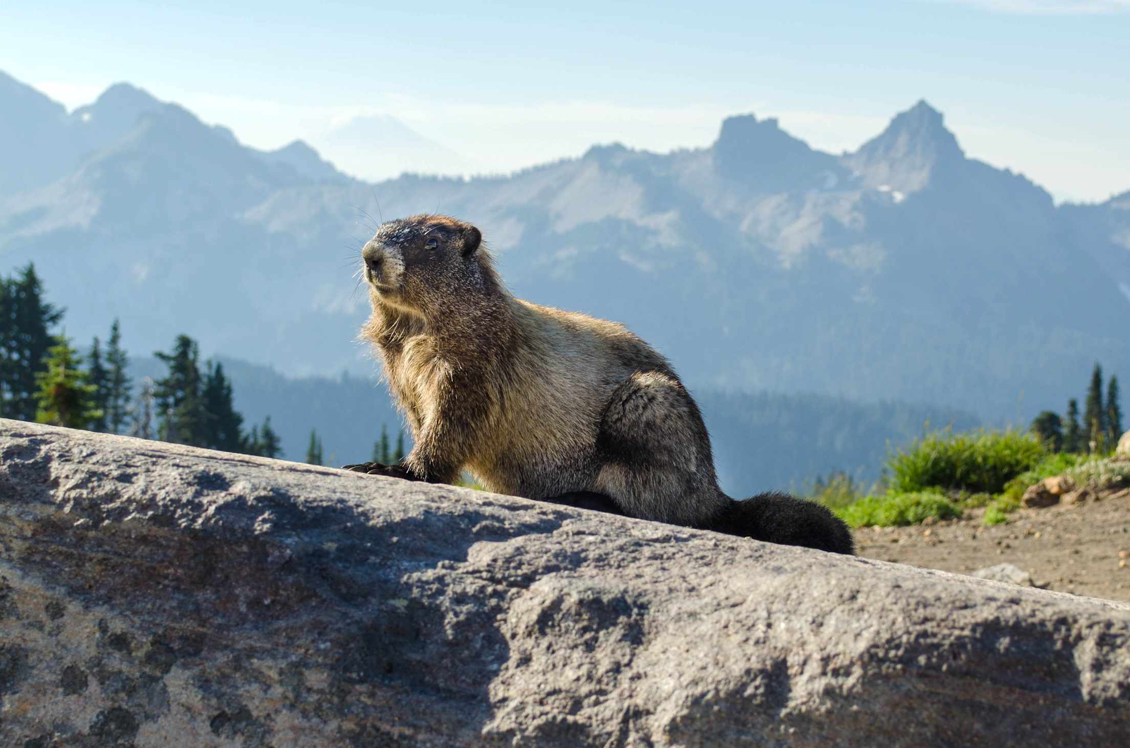
With 240 miles of maintained trails, hikers of just about any skill level can enjoy a variety of ecosystems and spot wildlife from a safe distance—think eagles, hawks, black bears, coyotes, bobcats, marmots, Cascade red foxes, and any number of little critters. You can help preserve them and the area by observing all rules and taking the Mt. Rainier Pledge.
Try a stretch of the 93-mile Wonderland Trail that circles Mt. Rainier. One segment near Longmire takes you to Carter Falls. Also nearby, the Trail of the Shadows is a family-friendly interpretive walk just over a half-mile with a historic cabin, beaver pond, and old-growth trees.
If you’re seeking wildflowers (along with many fellow visitors) meander up the Skyline Trail, which starts at the Henry M. Jackson Visitor Center at Paradise. The subalpine meadows are bursting with color at their peak in July and August. Continue upward to Panorama Point at 6,800 feet.
Near the Ohanapecosh campground, the popular Grove of the Patriarchs trail is currently closed for restoration, but the nearby Eastside Trail cuts through similarly lush, forested landscape with ancient trees, some 500 or more years old.
Other Park Activities
Driving through the park is an experience in and of itself, allowing visitors to take in the dramatic geology. Stop at accessible viewpoints with amazing views at places like Inspiration Point and Backbone Ridge, both located on Stevens Canyon Road. There are also a number of private and group guided tours that originate in Seattle.
Cyclists will love Westside Road near the Nisqually entrance. It offers 13 miles of gravel for both bikes and ebikes, which aren’t permitted on trails or off-trail areas.
Backpackers should stop at the Wilderness Information Center at Longmire for updates on current conditions and the best areas to camp, and to get backcountry permits.
Where to Stay in the Park and Nearby
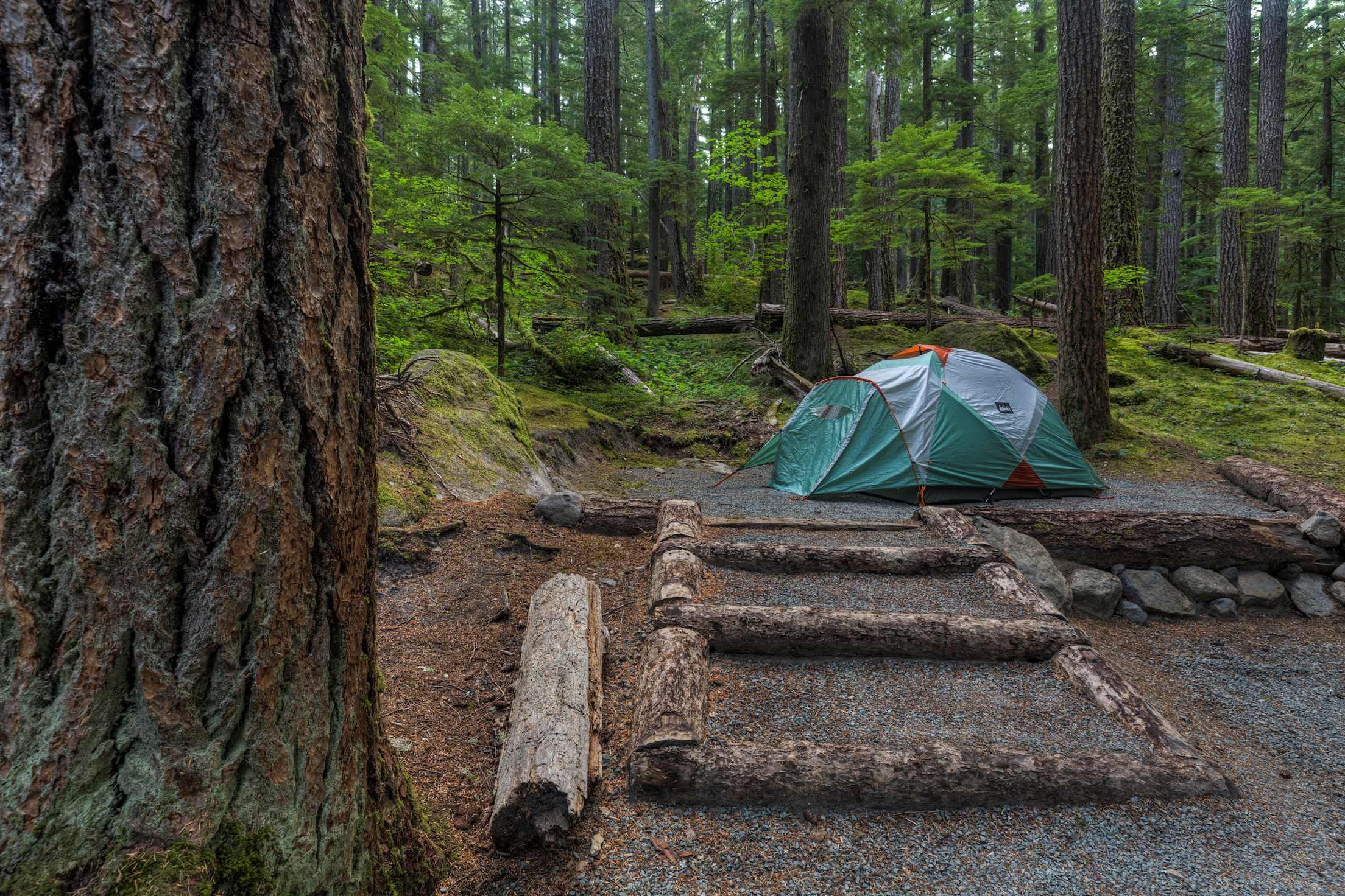
The park’s three campgrounds fill up early, especially on summer weekends. You can reserve a spot online from late May to early October at Cougar Rock in the southwest and Ohanapecosh in the southeast section of the park. The White River Campground in the northeast, estimated to open on June 21st, needs a first-come, first-served permit before you arrive, since cell service is limited in that area. Learn more at the park’s comprehensive camping site.
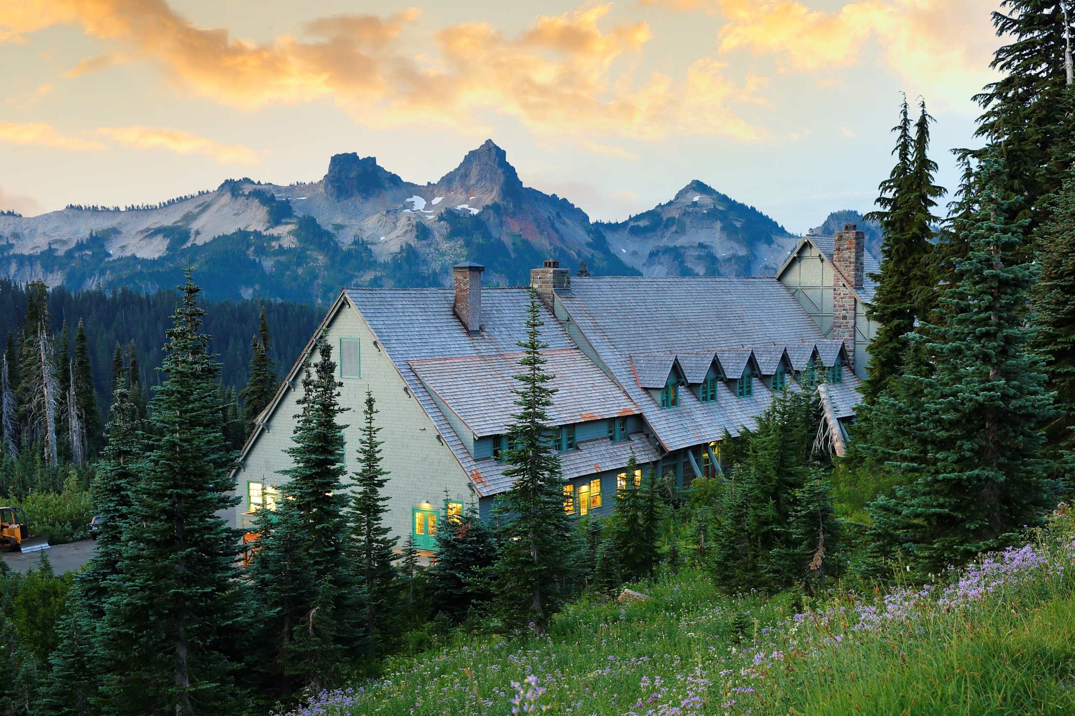
Not interested in sleeping outdoors? Book a cozy room at one of the park's two historic lodges, Paradise Inn and the National Park Inn in the Longmire Historic District. Both have dining and shops.
Outside the park, there are even more options. Relax in luxe rooms and private cabins at the new LOGE Alta Crystal around 8 miles from the park’s White River entrance. Six miles from the Nisqually entrance, the Big Creek Campground in the massive Gifford Pinchot National Forest is a cozy, family-friendly spot. Nearby, the town of Ashford offers cabins and lodge rooms for all budgets.