Donkeys, Ghost Towns, and Open Road on the Iconic Route 66
The most American highway turns 100 this year. Here’s why that’s worth celebrating.


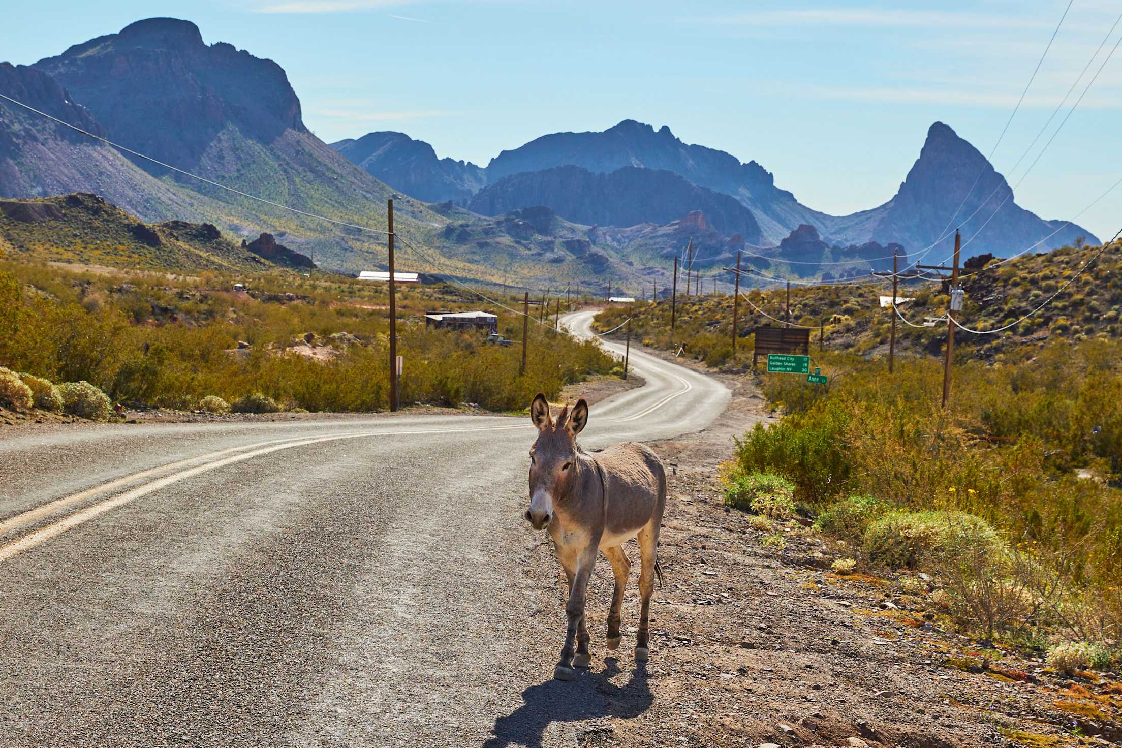
Oatman, Arizona, is probably the only place in the world where you’ll encounter a baby donkey with a sticker on its forehead advising you not to feed it treats. The residents of Oatman (population 98) look after the donkeys, and they don’t want people feeding the babies carrots or anything else that might present a choking hazard.
For the adult donkeys, however, treats are widely available for purchase. The burros have the run of the place: shamelessly nuzzling bystanders, staring into the shops, standing—or sometimes sleeping—right in the middle of the road. A donkey is, in fact, most likely the very first thing you’ll see as you drive into town.
Perched in a fold of the Black Mountains some 2,000 feet above the Colorado River at the far western edge of Arizona, Oatman seems an unlikely destination for tourists or anyone else who might pose a threat to baby burros. Except that the road those animals are blocking is the most famous highway in America: Route 66.
Despite being decommissioned as an official U.S. highway in 1985, historic Route 66 lives on. People from around the country and the world drive its length and visit towns like Oatman to connect with the land, the people, and the very American idea of a two-lane highway that reaches majestically for the horizon.
Vintage diners, neon-lit motels, and western Americana hark back to an age of tail-finned cars and colorful motor courts. Rusting bridges and crumbled asphalt testify to the first phases of intracontinental roadbuilding. Songs have been written about Route 66, movies made about it. And surrounding all of this—the legends, the lore, the landscapes, and the kitschy gift shops—a community of the road still exists.
Even now, on its 100th birthday, the Mother Road’s hold on the nation’s imagination remains strong. From the waves of Illinois grain to the coast of California, Route 66 has matured into a historical franchise. Today, it prevails as an expression of an American century, a 2,400-mile stretch of highway between Los Angeles and Chicago by which we can date the progress of a nation and the building of its character.
“The entire American story is wrapped up in this highway,” Jim Hinckley says. Hinckley guides tours and delivers lectures on Route 66, has written 10 books about it, and lives right by it. Driving the road, he says, is “the quintessential American experience.”
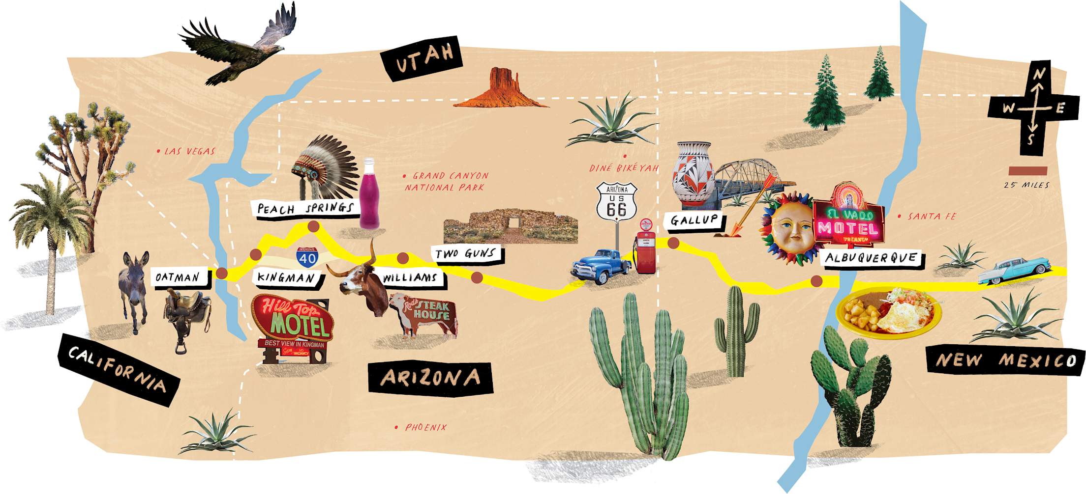
I recently set out to experience some of it myself. Small-town charms aside, what I wanted was to see the original Route 66, the last vestiges of the “original alignment,” as it’s known by aficionados. By standing atop the same weathered surface that had carried dust bowlers to new lives and felt the footsteps of troops mobilized for World War II, I thought I might understand what Route 66 has come to signify. So I drove east, from the California state line to the New Mexico-Texas line, to see it firsthand.
Rattlesnakes and Donkeys
Route 66 leaves California for Arizona over the Colorado River. The blue-green water of the river, some 500 feet wide, stands out in the searing Mojave Desert—good country for geologists and rattlesnakes. The elevation of the river here is 480 feet above sea level. From the border, Route 66 climbs toward the Intermountain West over a broken country of rock and cactus. As I drive toward Oatman that first day, dark, waterless mountains loom in every direction.
Oatman feels more like the Old West than any other town on Route 66. Boardwalks line the dusty street. Old saddles sit atop handrails like props for a western film. The donkeys add an agrarian vibe. At a quaint shop called Rock N Art, I buy two postcards of donkeys illustrated by local artists. The woman at the cash register tells me that the tourist season begins in October and that tourists are more important than rain. I ask how long she’s been living in Oatman, and she says, “Since before you were born.” She points me to the Oatman Hotel for a bite to eat.
Established in 1902, the Oatman is one of Arizona’s oldest hotels, and a warm, friendly place. The walls are papered with dollar bills, the tables covered in red-check cloth. Country music plays faintly behind the din of voices. I sit at a corner table and order a pulled-pork sandwich with homemade chips.
A dozen men walk through the door speaking German. They have red faces, and they wear the heavy boots and creaking leather garb of motorcyclists. They sit at a long table and look around, smiling and taking photos, as though they’re in a museum. Out in front of the hotel, lined up like a dozen horses tied to a hitching post, 12 matching Harley-Davidson touring bikes stand propped on kickstands.
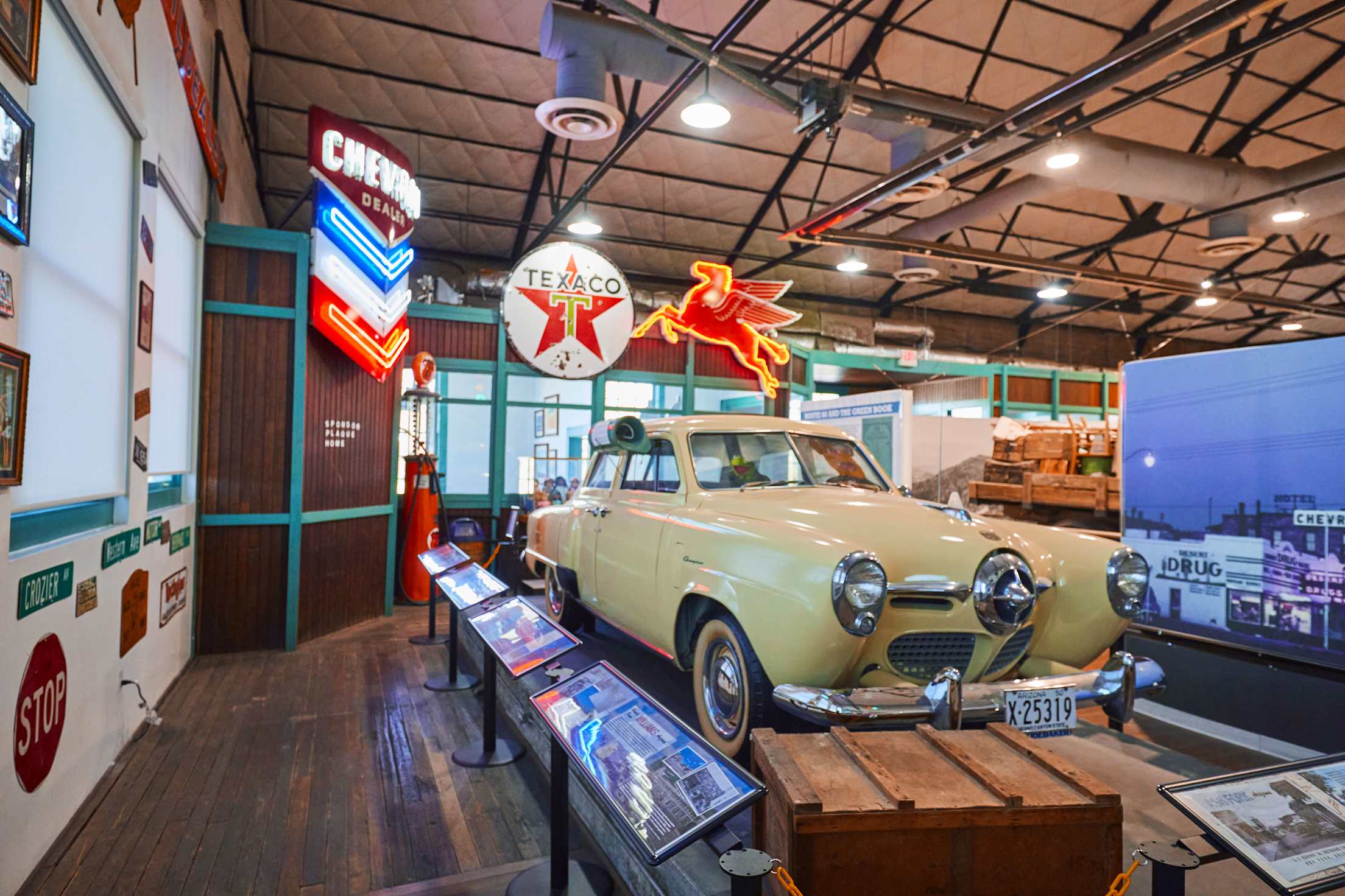
After Oatman, I follow Route 66 as it drops down to Kingman, home of the Arizona Route 66 Museum, the biggest attraction in town. The museum stands in an old building by the Burlington Northern Santa Fe railroad. It provides a thorough account of the highway’s history, particularly in Arizona, and offers a wide range of maps and guidebooks in the gift shop. When I hand my ticket to the man in the museum ticket window, he asks where I’m from. I tell him and ask where the other visitors are from.
“Let’s see,” he says, holding up his hands to count his fingers. “Singapore, Colombia, Israel, New Zealand, Poland, France, England, and Hungary. And that’s just this morning.”
I must look surprised, because he adds, “It’s all your Route 66 clubs, from all over the world.”
I tell him that I passed a convoy of very old-looking cars, maybe 20 of them, west of town.
“Oh yeah, they were just in here. They’re driving old Model T’s and Model A’s along the whole route—left Chicago two weeks ago,” he says.
Bypassed by the Interstate
The longest section of Route 66 that isn’t overlain by an interstate is the 158-mile stretch from Topock to Seligman, Arizona. After passing through Kingman, at the eastern extreme of the Mojave Desert, it ramps up to the Colorado Plateau, a high desert landscape of golden eagles, slickrock canyons, and long vistas. Forty miles from Kingman, the old road enters the Hualapai Indian Reservation and soon reaches the town of Peach Springs.
Interstate 40 began overlaying portions of Route 66 in the 1960s. That was the end of the highway’s heyday, and the beginning of yet another evolution in U.S. automobile travel. The interstate hurt a lot of businesses and towns along Route 66. The designated exits limited access and concentrated traffic. Peach Springs is one of the towns it bypassed.
The Walapai Market is the center of town, and its coffee shop is a hub for the community. “Verizon is the only service that works out here, so a lot of people come to use the Wi-Fi,” says the young cashier as she stacks cases of a grape soda called Navajo Fizz. She hands me a copy of the tribal publication, the Gam’Yu Newsletter. “‘Gam’Yu’ means ‘hello,’” she explains.
I ask her if there is anyone around who remembers Peach Springs before the interstate was built. She leads me to the back of the grocery store and through a swinging door to where an older woman with gray hair is putting price tags on packaged meat. She’s wearing an apron and plastic gloves. The cashier tells her what I’d asked.
“That’s a sad subject,” she says. “From the hill above town, where I grew up playing as a little girl, I could look down and see three motels and five gas stations. People always coming and going.”
She tells me that if I want to hear about the good old days, I should show up at the tribal headquarters on Tuesday for elders’ night; they’d tell me all I could stand to hear. She says a lot of people miss the passerby hustle. “The only time it’s like that now is when they shut down the interstate because of an accident or whatever, and everybody has to come through here,” she says.
The last portion of I-40 completed along Route 66 was near Williams, Arizona, 80 miles east of Peach Springs, in October 1984. The following year, Route 66 was officially decommissioned. The town of Williams, though, has retained its historic character.
“If you look at photographs from the 1970s, it looks like a miniature Las Vegas, with all the neon signs,” says Lea Bowdon. She’s the third generation of the family to run a shop that’s a trading post, antique shop, and Native American artist outlet called the Turquoise Tepee. (“We’re not a souvenir store,” she adds.) It was famous for the brilliant red-and-blue neon sign that once glowed above the entrance, but it has since been taken down.
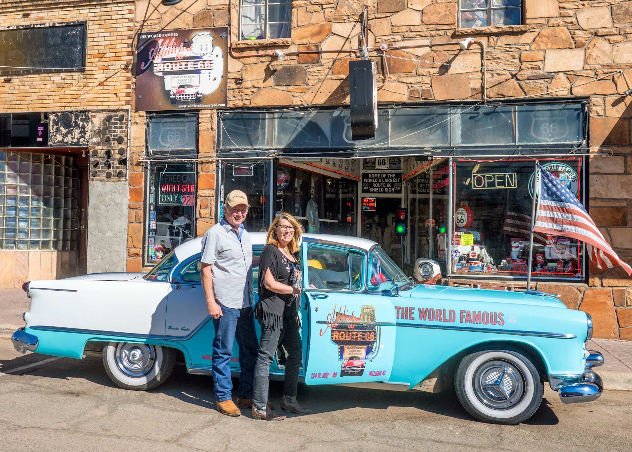
Next door to the Turquoise Tepee, I find the curio shop Addicted to Route 66, where the owner, Xavier Canale, is speaking French to three young men. It occurs to me that I hadn’t heard so many foreign languages since I was in Africa. After they left, Xavier tells me, “It’s been all French today.”
Xavier, who emigrated from France in the 1980s, says business is tenuously good these days. He shows me a photo of the shop from 1947; it was a curio shop back then, too. Same checkered floor after all these years, he points out. I ask him what he thinks the international tourists are looking for along Route 66.
“The American dream,” he says. “The open road, the small towns—some Europeans know more about Route 66 than most Americans.”
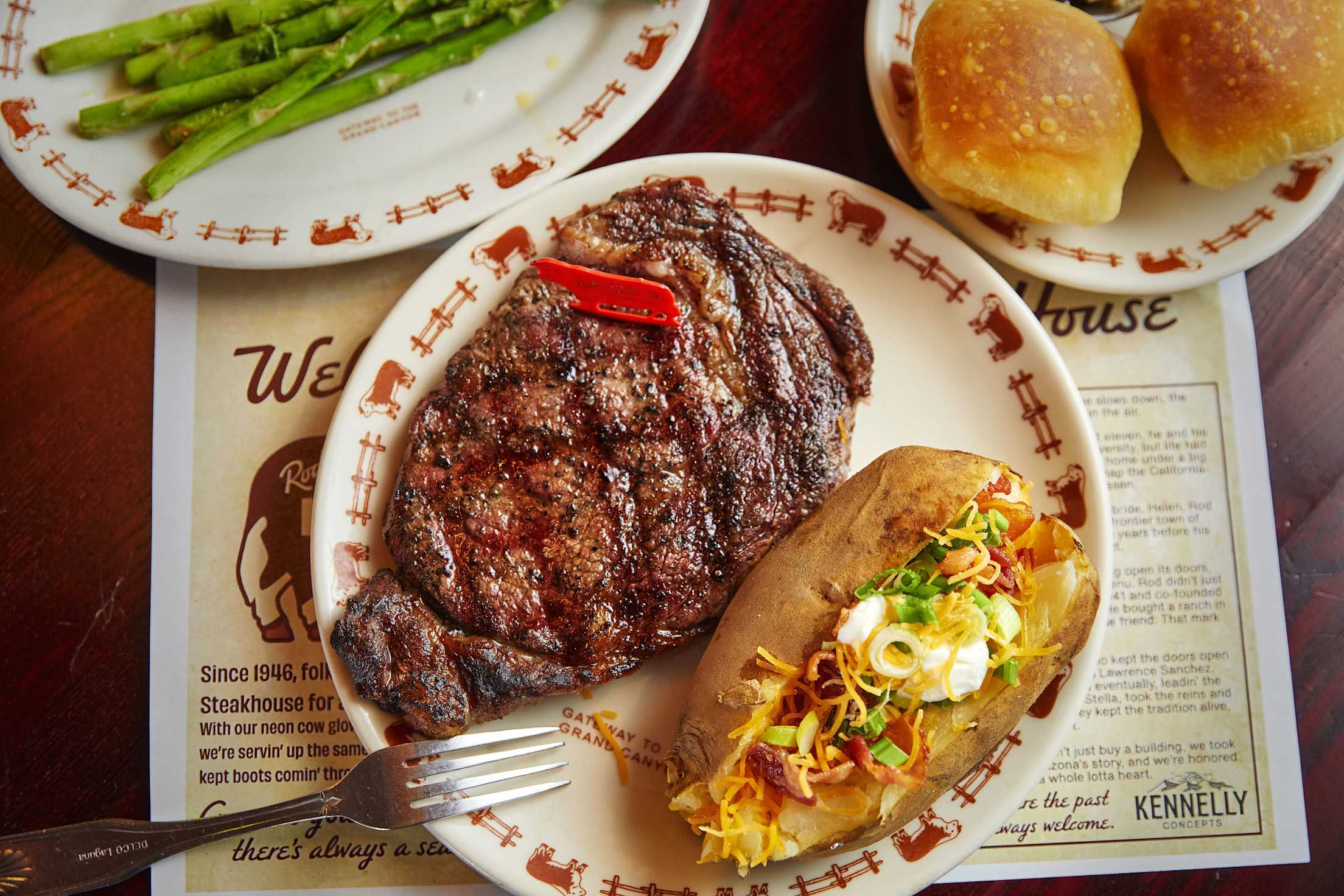
In Williams, I stay at the Lodge on Route 66 and walk the length of town at sunset. I eat a New York strip at Rod’s Steak House and have apple cobbler with vanilla ice cream for dessert. Route 66, I think, is like a theme park stretched out across half the continent.
Puzzle on the Landscape
Route 66 tops out at its highest point near Flagstaff at 7,335 feet above sea level. More than a vertical mile higher than where I started, it’s a completely different ecosystem. The San Francisco Peaks reach nearly 13,000 feet north of the highway and hold snow until June. Aspen groves and pine forests hem the highway as it runs through Flagstaff and downhill onto the arid plains of the Colorado Plateau.
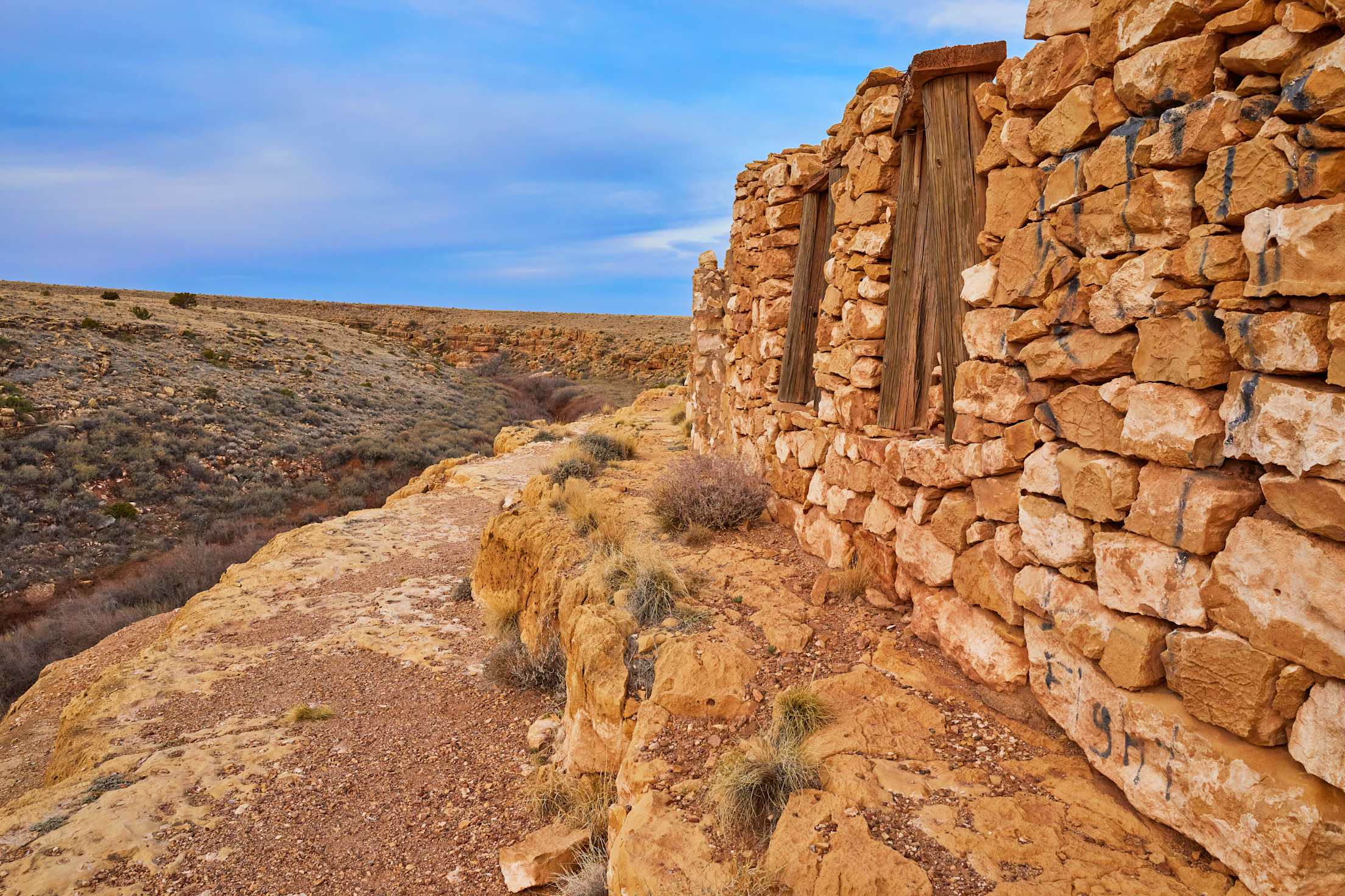
Of all the historic sites along Route 66, none is as perplexing as a place called Two Guns—exit 230 off I-40, about 34 miles east of Flagstaff. Today, it’s a ghost town, a collection of enigmatic ruins left over from its chaotic roadside career before the interstate. Over the years, Two Guns was a motor lodge, tourist trap, saloon, fueling station, campground, home to a zoo, and even the site of a murder.
The remnants of the zoo—enclosure gates hanging on twisted hinges, crude ceramic water bowls still in the corners, nowhere near enough fencing to contain the mountain lions or Gila monsters that Harry “Indian” Miller once kept there—look like the zookeeper simply walked away from it all a hundred years ago. Fake Native American ruins line cliffs within easy view of what was once a functioning motel.
Two Guns is a puzzle on the landscape. You can walk among the ruins and stand in the gaping stone doorway of the old trading post where Miller shot his neighbor in cold blood. There’s no signage, no interpretive kiosk, and no shade trees. What’s left of Two Guns stretches the imagination.
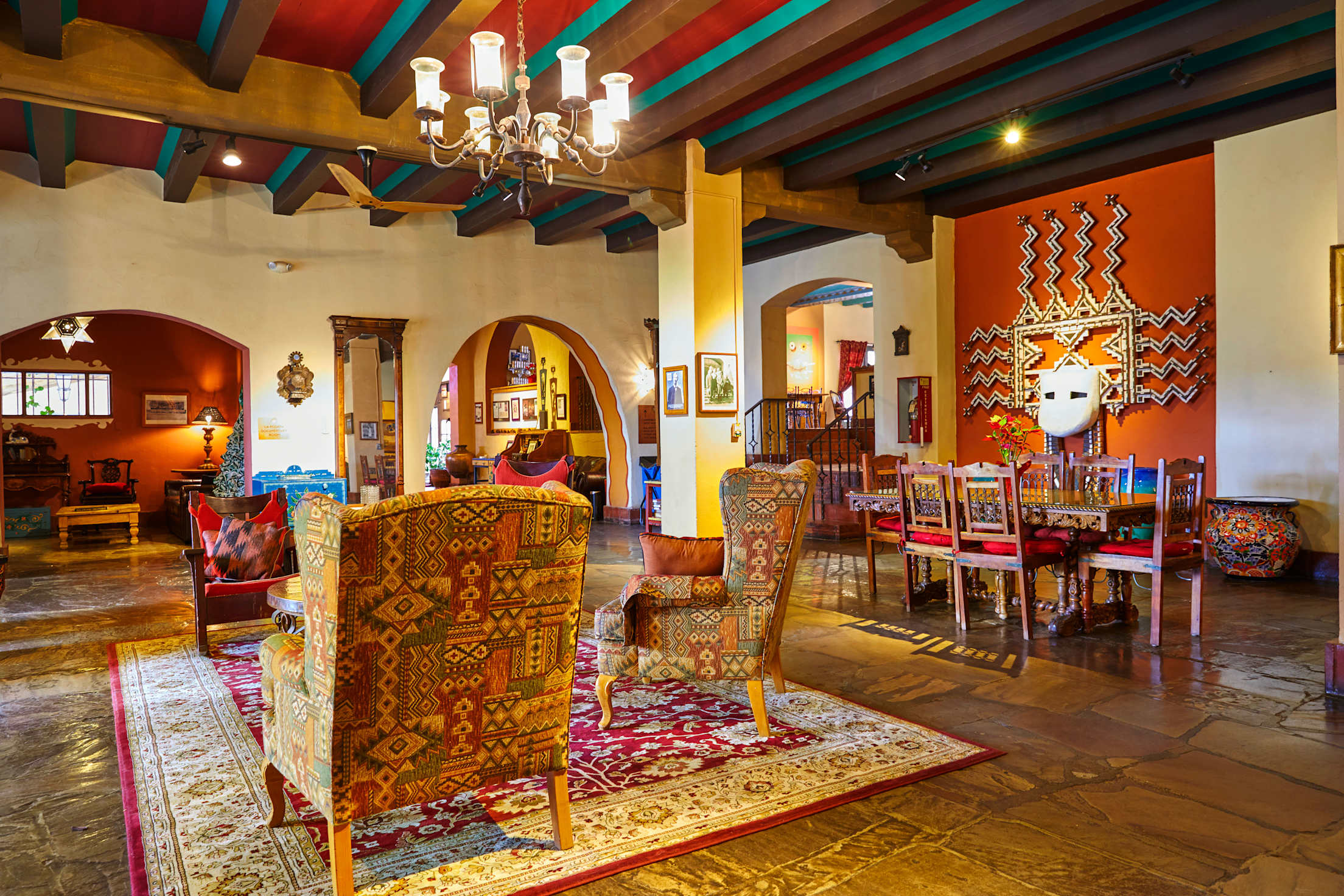
While the level of hospitality at Two Guns is left to speculation, 24 miles down the road, La Posada Hotel in Winslow leaves nothing for want. It’s one of the classic hotels of the Southwest, one of the last remaining Harvey Houses in operation. Harvey Houses were roadside hotels that emerged in the late 1800s and achieved a famously high standard of comfort.
La Posada fully answers to its reputation. Lush gardens complement the Spanish colonial revival architecture. The curated selection of books for sale in the gift shop keeps me there a half hour after a restorative lunch of carnitas and lemonade.
Where Route 66 crosses the New Mexico state line, trading posts—some shuttered, some open—sit below a natural sandstone amphitheater that looms over the highway. At the Yellowhorse Trading Post, I buy a pair of baby moccasins—handstitched elk hide, dyed gray, and fringed in white. Devin, the young Diné man who sells them to me, grew up at the trading post and knew it in the 1990s when Frank Yellowhorse, whose portrait hangs on the south wall, ran the place.
Business then was robust. Mexican pottery came in by the truckload from the south, Diné artistry came from the north, and tourists came for what they couldn’t find back home. It’s slower these days, Devin says—not as much because of the interstate as online shopping. “People would just rather buy stuff from Amazon,” he says. “Or they say, ‘I can just eBay it.’”
The highway crosses the Continental Divide east of Gallup, at an elevation of 7,295 feet, about 50 miles inside the state line. It passes under the shadow of Mount Taylor, which historically marked the southeast corner of Diné land, and into the Puebloan cultures of the Rio Grande Valley.
Just 15 miles south of Route 66, Acoma Pueblo is one of the oldest continually inhabited places in the United States. It sits atop a sandstone mesa that rises bolt-upright 357 feet from the valley floor. People first lived on the mesa more than 1,000 years ago. The Spanish conquistadores, in the 16th century, could initially neither find a way up the mesa nor bring their firepower to bear on it. But after a series of strained encounters, the Pueblo was eventually taken by siege.
The Sky City Cultural Center and Haak’u Museum is open to the public, and tours of the mesa-top pueblo are offered Friday through Monday, weather and residents permitting. (“Because people still live there,” explains the man who sells me my ticket.) A woman selling pottery outside the cultural center tells me that the best times to visit are feast days (open to the public) and the annual art show and sale on Thanksgiving weekend. I come away feeling like it was one of the most organic sites of habitation on the continent.
Straight for 50 Miles
A few miles west of the Albuquerque metropolitan fringe, Route 66 Casino Hotel lights up the surrounding desert like an international airport. Just east of the casino and on the opposite side of the interstate is the old Route 66 bridge over the Rio Puerco. Originally fabricated in Kansas City in 1933, the bridge is a Parker through truss design, not often seen in New Mexico. It’s an impressive steel structure, a work of industrial art. As I pull up, I see two matching Harley-Davidson motorcycles parked there.
I say good morning to a man leaning on the bridge guardrail. His name is Thomas, and he’s from Bath, England. He and his friend rented their bikes and left Chicago seven days prior. They are averaging about 250 miles per day and have only had to use their rain gear once, in Oklahoma.
For most of Thomas’ adult life, riding a motorcycle across the U.S. had been a goal for his retirement, to see “America proper,” he says. His wife recently told him that if he waited until retirement, he might be too old to make the ride and that it was time to “crack on.” So far, the trip has been everything he’d hoped for.
“I spoke to me mum and dad this morning, and I told them, ‘You wouldn’t believe it: a road that’s straight for 50 miles, no turns, no trees, barren land on either side as far as the eye can see,’” he says.
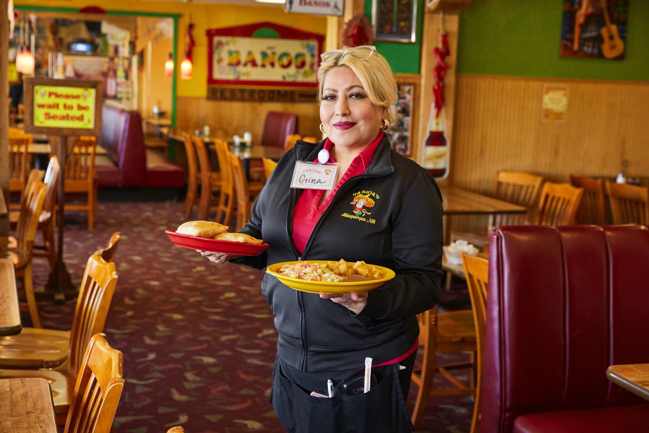
Route 66 runs straight through the center of Albuquerque. I stop at Garcia’s Kitchen for a classic New Mexican lunch of cheese enchiladas with a fried egg and posole. East of the city, the road cuts through the Rocky Mountains and spills out onto the Great Plains, where the horizon to the east is as flat as the sea. Remnants of Route 66 reappear between jogs in the interstate and as main streets for the wayside towns—Moriarty, Santa Rosa, and Tucumcari. Cornfields appear. The last rimrock topography—a red mesa south of the highway—drops out of sight as the Texas state line comes into focus.
Just before Route 66 leaves New Mexico, a stretch of the original alignment emerges in the prairie. Old bridges made of rusted cable and creosote-coated timbers span washouts in the scrub brush. Those bridges look dated, but the roadway is coated with modern gravel.
As I stand at the end of one of the bridges, looking toward Texas, I see something crossing the road. It’s a box turtle, maybe 5 inches from head to tail, its shell patterned like a leopard’s. Two parallel sets of tracks mark its slow progress, south to north; it has finished a quarter of the crossing so far.
With all the traffic that’s still on the original highway, I think it won’t be long before a visitor from Europe comes skidding to a stop on a motorcycle, trying to avoid the turtle in the road, and rolls the bike into the ditch. So I pick up the creature and set it on the grass on the side of the road. Then I walk back to my car and continue on my way.
AAA Members save up to 20% off the base rate* of a Hertz rental.